Bloodmoon:Places
The UESPWiki – Your source for The Elder Scrolls since 1995
< Bloodmoon(Redirected from Bloodmoon:Cities & Towns)
Maps[edit]
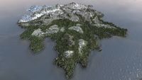
For maps of Solstheim see:
- Morrowind Satellite Map - A high-resolution map of Vvardenfell and Solstheim using the Google Maps API.
- The Imperial Library Cartography - Many different kinds of maps here.
- Official Map of Solstheim - Official paper map of Solstheim.
Regions[edit]
- Felsaad Coast — Solstheim's northeastern coast.
- Hirstaang Forest — Solstheim's hospitable southern forest.
- Isinfier Plains — Solstheim's central tundra.
- Moesring Mountains — Solstheim's northwestern mountain range.
Cities, Towns, and Settlements[edit]
Major Settlements[edit]
- Fort Frostmoth — An Imperial Fort on the fringes of the Empire. (map)
- Raven Rock — A small Imperial mining colony. (map)
- Skaal Village — A Nordic settlement of devout nature-worshippers. (map)
- Thirsk — A Nordic mead hall famed for hospitality. (map)
Smaller Settlements[edit]
- Geilir the Mumbling's Dwelling — A home located south of Thormoor's Watch. (map)
- Graring's House — The home of Graring, located in the northern tip of the Isinfier Plains, where the Harstrad and Isild rivers meet. (map)
- Kjolver's Dwelling — A small dwelling located between Brodir Grove and the Cave of Hidden Music. It is north of the Raven Rock settlement. (map)
- Kolfinna's Dwelling — A small cave dwelling along the western bank of the Iggnir River, northeast of Fort Frostmoth. (map)
- Ulfgar the Unending's Dwelling — A home located in Brodir Grove. (map)
- Uncle Sweetshare's Workshop — A home located south of Lake Fjalding and east of the Iggnir River, in the Isinfier Plains. (map)
Landmarks[edit]
- Brodir Grove — A landmark in Solstheim located on the border of the Isinfier Plains and the Hirstaang Forest. (map)
- Castle Karstaag — A fortress in the northwestern region of the island, in the Moesring Mountains region. (map)
- Hrothmund's Bane — A large Nordic memorial presumably built by the inhabitants of Thirsk after the death of their first chieftain, Hrothmund the Red. (map)
- Hvitkald Peak — A large, steep mountain northeast of Thormoor's Watch. (map)
- Mortrag Glacier — A completely frozen mass of ice, totally free of vegetation and beasts, located on the northwest side of Solstheim. (map)
- Thormoor's Watch — A vantage point located on the northwest area of Solstheim, in the Isinfier Plains. (map)
- Altar of Thrond — Located in the middle of the island of Solstheim, in the Isinfier Plains. (map)
- Patchwork Airship — A vessel crashed on the Isinfier Plains, northwest of the Altar of Thrond. (map)
Sacred Stones[edit]
- Beast Stone — A stone pillar south of the Skaal Village. (map)
- Earth Stone — A stone pillar northwest from Raven Rock. (map)
- Sun Stone — A stone pillar northeast from Fort Frostmoth. (map)
- Tree Stone — A stone pillar in a valley northeast of Brodir Grove. (map)
- Water Stone — A stone pillar on the mountainside east of Hvitkald Peak. (map)
- Wind Stone — A stone pillar on the western shore of Harstrad River. (map)
Bodies of Water[edit]
- Harstrad River — A stream that forms the eastern boundary of the Moesring Mountains. (map)
- Iggnir River — A river in southern Solstheim in the Hirstaang Forest region. (map)
- Isild River — A river in northern Solstheim on the Felsaad Coast. (map)
- Lake Fjalding — A frozen lake in the Felsaad Coast region of Solstheim. (map)
Barrows and Tombs[edit]
- Bloodskal Barrow — A burial ground on the northern border of the Hirstaang Forest, north-northwest of Raven Rock. (map)
- Connorflenge Barrow — A small burial ground east of Uncle Sweetshare's Workshop, along the coast. (map)
- Eddard Barrow — A small burial ground halfway up the island from Fort Frostmoth, northeast of Raven Rock. (map)
- Frosselmane Barrow — A small burial ground east of Fort Frostmoth, between the mouth of the Iggnir River and the inlet to its west. (map)
- Glenschul's Tomb — A small tomb just southeast of Lake Fjalding. (map)
- Gyldenhul Barrow — A small burial ground on an island off the Felsaad Coast. (map)
- Himmelhost Barrow — A small burial ground just east of the Iggnir River, about halfway between the mouth and the east shore. (map)
- Hrothmund's Barrow — A burial ground southwest of Castle Karstaag. (map)
- Jolgeirr Barrow — A fairly small burial ground southwest of the Altar of Thrond, roughly in the center of the island. (map)
- Kelsedolk Barrow — The tomb of a deceased Nord on the western coast, a short distance south from Raven Rock. (map)
- Kolbjorn Barrow — A burial ground south of Raven Rock and west of Fort Frostmoth. (map)
- Lukesturm Barrow — A small barrow directly south of Thirsk and northeast of Brodir Grove. (map)
- Skogsdrake Barrow — A medium-sized burial ground just north of the Sun Stone. (map)
- Stormpfund Barrow — A medium-sized burial ground just west and a bit north of Fort Frostmoth. (map)
- Tombs of Skaalara — An important cavern for the main quest, on the eastern coast of the island, southeast from Skaal Village. (map)
- Valbrandr Barrow — A burial ground northeast of the Sun Stone and Skogsdrake Barrow. (map)
Caves[edit]
- Benkongerike — A large system of ice caves, located northeast of Castle Karstaag, along the white northern shores of the Moesring Mountains region. (map)
- Bjorn — A system of ice caves northeast of the Altar of Thrond and almost directly east of Hvitkald Peak. (map)
- Caves of Fjalding — An ice cave system located on the Felsaad Coast underneath Lake Fjalding. (map)
- Cave of Hidden Music — A cave system located on the Isinfier Plains, northeast of the Earth Stone and northwest of Brodir Grove. (map)
- Domme — A Fryse Hag lair south of the Mortrag Glacier. (map)
- Fjell — A small treasure cave located on the Isinfier Plains to the east of Brodir Grove. (map)
- Frossel — A system of ice caves located southeast of Skaal Village, on the northeastern corner of the Felsaad Coast. (map)
- Frykte — A small ice cave located east of Castle Karstaag. (map)
- Gandrung Caverns — A smugglers hideout northeast of Fort Frostmoth. (map)
- Gloomy Cave — Located just southwest of Lake Fjalding, north of Brodir Grove. (map)
- Gronn — A system of ice caves located southwest of Lake Fjalding on the Isinfier Plains. (map)
- Halls of Penumbra — A medium-sized cave near the Sun Stone in southeastern Solstheim. (map)
- Lair of the Udyrfrykte — A small ice cave on the eastern shore of Lake Fjalding in the Felsaad Coast region. (map)
- Legge — A small ice cave north of Graring's House. (map)
- Rimhull — A small ice cave located west of Skaal Village. (map)
- Sjobal — A small ice cave located northeast of Thirsk. (map)
- Skygge — A small ice cave located west of Skaal Village and north of the bridge across the Isild River. (map)
- Solvjord — A cave due south of the Tree Stone and north of Fort Frostmoth. (map)
- Stahlman's Gorge — A small cave located far west of Mortrag Glacier. (map)
- Varstaad Caves — A cave on the coast in the Moesring Mountains area, north of the Water Stone. (map)
Ships[edit]
- Supply Ship — A vessel that ran aground about halfway up on the island's west coast, in the Isinfier Plains region. (map)

